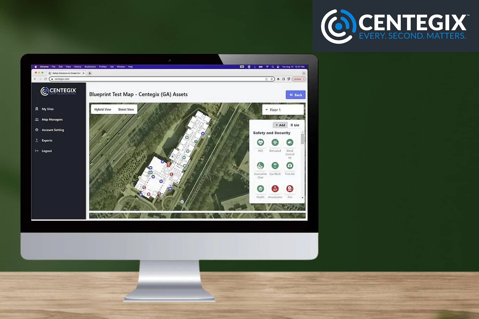
Critical incident mapping, or digital mapping, uses images and data points to create a digital (and sometimes interactive) map of a building and its surroundings.
A digital mapping system makes it easier for law enforcement and first responders to get an accurate view of your campus grounds, available safety assets, security resources, evacuation points, and other user-defined information.
With such detailed campus visibility, school administrators can improve safety planning, improve communication with first responders, and ultimately accelerate incident response times.
Campuses across the country are switching to digital mapping and interactive school safety solutions for several reasons:
- Knowing where an emergency is accelerates response detailed maps show precisely where help is needed and enable first responders to navigate quickly to mitigate harm.
- Maps aren’t helpful if they aren’t immediately accessible in an emergency. Digital maps help multiple units collaborate in an emergency response
- Outdated maps can do more harm than good. Updating digital maps can be done quickly and efficiently to reflect restructuring and the addition of safety assets like AEDs, lock boxes, cameras, access control, and more.
- Maps should be shareable to promote a collaborative approach to school safety and a benefit to the greater community.
Safety Blueprint Digital Mapping Puts Your Campus’s Safety At Your Fingertips
CENTEGIX’s Safety Blueprint™ is an intelligent incident response mapping solution that helps schools, hospitals, government agencies, and other campus-based organizations optimize incident response, safety planning, and visitor management.
In an emergency, whether it involves one individual or a campus-wide response, every second matters, so you must know precisely where the AEDs, fire extinguishers, first aid kids, emergency shut-offs, and evacuation points are.
Safety Blueprint highlights existing security camera infrastructure to help responders utilize camera assets nearest to an emergency to understand the type of situation underway from a logistical and practical standpoint.
With a digital mapping system like Safety Blueprint, your team will have all pertinent information immediately available to emergency responders, enabling them to make the most of every second.
CENTEGIX Safety Platform: A Layered Approach to Safety
Accelerated response times can save lives and mitigate trauma and injury when a crisis occurs on a school campus.
CENTEGIX Safety Platform grants first responders real-time access to dynamic campus maps with incident response notifications.
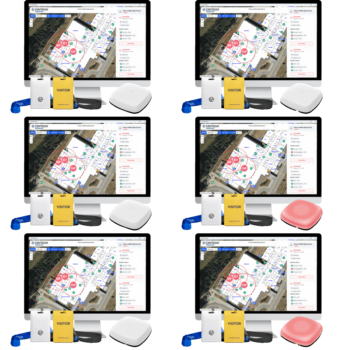
The CENTEGIX Safety Platform combines critical incident digital mapping with wearable mobile panic buttons, enhanced visitor management, and reunification tools.
- Safety Blueprint is a digital mapping tool that integrates with existing safety technology to create digital incident response maps with real-time editing.
- CrisisAlert™ empowers teachers and staff across your campus to request help or trigger a campus-wide response with the push of a button.
- Visitor Management completes a background scan on each school visitor when they check in, checking against state sex offender registries and your school’s proprietary no-go list.
- Enhanced Visitor Management gives you real-time visibility into who is on campus and where. It also tracks visitors’ time and movement on your digital campus maps.
- Reunification quickly reunites students, staff, personnel, and parents during an emergency.
Safety Blueprint Works With CrisisAlert To Accelerate Response Times
CrisisAlert is a wearable mobile panic button that empowers teachers, administrators, and staff to initiate alerts.
From a simple request for assistance to a full-campus lockdown, CrisisAlert gives its wearers the power to act immediately and discreetly. The badges also transmit location data during a crisis to pinpoint exactly where help is needed during emergencies.
Together, Safety Blueprint and CrisisAlert help administrators and first responders locate staff, teachers, visitors, and safety assets during extreme or everyday emergencies. The dynamic digital mapping system helps first responders find the safety assets they need en route to the emergency, providing the proper response to the correct location, right on time.
CENTEGIX’s Safety Platform also gives local emergency responders access to the same information as key school personnel (administrators, facilities managers, safety decision-makers, and designated staff).
Most schools and emergency responders have begun to move away from paper maps, but even with the evolution in technology, many are still using static PDFs on laptops and tablets. Updating a static PDF requires everyone has access to the most recent version of the file and knows which version is the most recent.
With Safety Blueprint, maps display alerts in real-time and everyone works from the same updateable source ensuring everyone can access the most recent, most accurate information.
How Schools Use Digital Mapping and CENTEGIX Safety Platform in the Real World
“The CENTEGIX badges have been a game changer for us. There have been multiple situations, including seizures, a dislocated knee, an allergic reaction, a couple of classroom altercations, and a threatening individual, that have prompted staff to use the three-button press. Our staff response time is significantly shorter with this tool. Responders reach the incident location in 30 seconds or less, regardless of the location on campus. Thankfully we haven’t had a need to use the tool for a full school lockdown as of yet, but I’m sure it will happen, and when it does, we will be ready. The decision to move to CENTEGIX was, in my opinion, a great one.”
– Sara Bravo | Principal, Mandarin High School, Florida
“The minute we receive a map in an architectural drawing or PDF is the minute it is out of date! If I have to call an architect or vendor to update maps, I waste time and money. CENTEGIX’s Safety Blueprint is the best of both worlds: we can make updates in real time, and we don’t have to spend money every time we make a change, like consolidating rooms or adding a mobile classroom. The assessment management and inventory management capability is icing on the cake.”
– Chris Farkas | Chief Operations Officer, Hillsborough County Public Schools, Florida
“Safety and Security is everyone’s responsibility, so if we’re going to make that everyone’s responsibility, then everyone needs to be empowered to have a voice. These are public schools, and parents entrust their children to us every day.”
– Michelle McCord | Superintendent, Frenship ISD, Texas
“If [mapping] is not integrated with a crisis response system that can be pushed electronically to the dispatch center and police, then it’s probably not going to mean anything to them in the first minutes,” Jeremy Gulley, the school system superintendent of Jay Schools Corp., Indiana.
“Workplace safety [is the] number one issue not only for the schools but also throughout the nation, so this gives an extra level of security for our staff members.”
– Frank Stanage | Human Resources Director, Alamo Heights ISD, Texas
“We didn’t want to go with a system that would ask our teachers to download an app or have to fumble through a phone or have to run to a panic alert button. The CrisisAlert system is a really small device; it’s wearable… and it’s inconspicuous.”
– Lisa Cantu | Federal Programs Director Mercedes Independent School District, Texas
“Our local school district chose CrisisAlert to protect its staff and students, and we appreciate the implementation with CENTEGIX. Alert data comes to us through our existing inbound process and does not require any additional software in our PSAP, which makes it easy to implement the solution for our staff.”
– Christina Mortimer | Director of Communications, Flagler County Sheriff’s Office, Florida
Our previous mobile app didn’t work because there were simply too many places on campus where the service was unavailable. We switched to CENTEGIX because there was nothing else that compared in terms of complete campus coverage and ease of use.
– Frank Frangella | Chief of Safety and Security, Martin County School District, Florida
“For our staff, it has been mindblowing [with the badge and the safety network having access to CENTEGIX technology], they now feel valued. We now have 2,000 additional eyes and ears on the safety of not only Yakima School District, but also the community as a whole and I can tell you what a difference that has made when we talk about a comprehensive culture of safety.”
– Stacey Locke | Deputy Superintendent at Yakima School District, Washington
“Safety is an everyday thing in our world. Everybody’s taking ownership in that building and letting us know what’s going on.”
– Ron Self | Director of Safety & Security Little Rock School District, Arkansas
“I would say to that superintendent above everything else, safety comes first. And I’m sure that superintendent feels that way in their heart as well. And I don’t know of another product out there that can help control the response time to emergencies. Whether it is a whole campus situation—the unthinkable—or these different medical emergencies, or classroom events. I cannot think of anything that’s going to speed up a response the way this does, or enable as many employees to be able to get help and initiate a response.”
– Dr. Kim Morgan, Superintendent of Brantley County Schools, Georgia
Ready to get more from your maps? Request a demo today.


